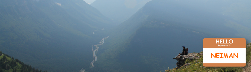
 Section 8 of the Appalachian Trail is another long one, covering more than 300 miles of CT, MA, VT, and NH. There are plenty of town stops within a mile of the trail here though, so no need to worry about carrying too much food at a time. In addition, there are some nice treats along the way to look forward to, like the Cookie Lady, Cloudland Farm, and Dartmouth College. However, since my plan for this section calls for a lot of 20+ mile days, hopefully I won’t be too exhausted or ornery to enjoy them. Hello Neiman!
- Start of Section: Kent / Connecticut Border (1468.4)
- End of Section: Glencliff (1792.2)
- Total Miles: 323.8
- Total Days: 19.0
- Avg Daily Miles: 17.3
- Planned Town Stops: 6
Highlights and Preview of Section 8
- Hiking into trail towns is almost always downhill, and climbing out again is almost always uphill. Kent is no different, seeing about 500 ft elevation gain in the first half mile. Start the day with a hearty breakfast and get a-climbing!
- 1479.5 – If you forgot to resupply anything in Kent, you are met with a town crossing just a few miles later at Cornwall Bridge, CT. This small town is 0.9 miles east of the trail and contains some small markets and an outfitter.
- 1493.4 – The next small town within a mile of the train is Falls Village. Here you can find an Inn, a cafe, and a free outdoor shower on the outer wall of the vine-covered Hydroelectric Plant. A trail journal from 2017 SOBO Hiker 12 Ounce called it “old but the shower, power outlet, and garbage can were everything a hiker could ask for.” (side note, as I read more of 12 Ounce’s blog, I was sad to see she departed a couple days later because of how lonely the AT felt).
- 1500.7 – One more town stop before departing Connecticut is Salisbury. I plan to stop here, where it is popular to stay with trail angels Maria McCabe or Vanessa Breton. If they have a bed available, I’ll gladly take it.
- 1506.9 – After a quick jaunt through Connecticut, the trail now crosses into Massachusetts.
- 1518.1 – At the crossing of MA 41 is South Egremont, home to the ATC New England Regional Office. The office is located in the Kellogg Conservation Center.
- 1541.2 – Jerusalem Rd will take you a short 0.6 miles west to Tyringham, MA for resupply or a bed for the night.
- 1549.2 – Check out Upper Good Pond Cabin here in the Berkshires, exclusive to AT thru-hikers and section hikers. The cabin is owned by the NPS but managed by AMC and offers six double bunks, four tent platforms, a covered porch, fireplace, and an outhouse.
- 1560.3 – The Cookie Lady lives less than 100 yards off the trail at the Washington Mountain Rd intersection, providing free baked cookies for hikers for decades. Nearly all the hiker biographies mention her warm welcome, free water, blueberry bushes and opportunity to buy a coke or an ice cream bar.
- 1569.8 – Another town the AT walks right through is Dalton, MA. There are a few reasons worth noting to take a break here, for me most notably being the Movie Theater and Ice Cream Parlor.
- 1578.6 – Welcome to Cheshire, MA. This walkthrough trail town has your typical finds (Dollar General Store, Travel Lodge, Shell Gas Station) … but also, a Dunkin Donuts! Yes, your jelly-filled delight is just a short 0.2 mile walk away. Given how
- 1587.0 – Mount Greylock is the highest peak in Massachusetts, and it is definitely going to be a hike to get up, climbing 3,000 ft steadily over 5 miles. At the top sits Veterans War Memorial Tower, which provides a great view to the Green, Catskill, and Taconic mountain ranges and surrounding towns.
- 1597.4 – Crossing the border to Vermont here brings us to our 12th state along the trail. This also marks the southern end of the Long Trail, a 273-mile trail that hikes the length of Vermont in these Green Mountains.
- 1638.1 – Stratton Mountain is another big climb, gaining 2000 ft over 5 miles and losing it in the same amount of time. The summit of Stratton is supposedly where Benton MacKaye was first inspired to propose creation of the AT in 1921.
- 1654.8 – If you are sick of shelters on the trail, try the Bromley Mountain ski warming hut on the mountain here. This is a nice cabin overlooking the mountain and ski slope.
- 1675.8 – A short blue blaze trail (0.2m) will take you to White Rocks Cliff, a stunning view and drop off for the brave.
- 1702.9 – The Long Trail and Appalachian Trail divide here at the Maine Junction. Stay right to continue on to Katahdin!
- 1705.0 – Just after the Maine Junction, the AT crosses through Gifford Woods State Park in Killington, VT. In hiker talk, State Park = Showers.
- 1731.8 – If you pass through Thur-Sat, check out the Cloudland Farm Market with local ice cream, cheese, beef jerky, sandwiches and other prepared foods. Yum.
- 1747.3 – The town of Norwich has an inn, bookstore, library, pub and general store. But if you go just a bit further …
- 1748.2 – The VT-NH border, state #13. Followed shortly after…
- 1748.8 – Hanover, NH home of Dartmouth College. There are tons of services and offerings in this popular college town. To make it easy for you though, have your first stop be at the DOC, PO, Library or Co-Op to pick up a free brochure of all the hiker services in town, produced by the Hanover Friends of the AT Club.
- 1754.6 – Another town stop here is Etna, NH with some resupply and housing options.
- 1772.1 – The previous 20 miles or so provide some pretty strenuous mountain climbing, as the trail gets close to the White Mountains. The peak of Smarts Mountain has an old Fire Wardens Cabin converted to AT Shelter, which is fully enclosed for a slightly more comfortable night’s stay.
- 1792.2 – After a couple more vigorous scaling of peaks (Mt. Cube, Mt. Mist) you finally hike down into Glencliff, NH. A post office and hostel meet you, though not much more unless you want to head off-trail (4 miles south) to Warren, NH for a bit more amenities.
For me, completing this section is a major milestone in my hike. The next section is the White Mountains and the AMC managed Huts. These are a beautiful reprieve from the normal canopy cover of the trail and dirty 3-walled shelters that hikers are accustomed to by now. The White Mountains are as close to the Rockies as I can imagine this trail gets, and hiking hut to hut for a warm bed and hot meal will surely be a treat. However, logistically, this gets a bit tough for me now, as one 1 of two things is going to happen:
- Assuming the timing lines up, I’ll be hopping off trail a couple days later at Franconia Notch, renting a car, and driving down to Pennsylvania for a wedding on June 23rd. After a few days celebrating, I’ll drive back up, drop the rental car off, and continue on to the Presidential Range of the White Mountains.
- If the timing doesn’t work out, and I’m still somewhere south of Franconia Notch, then I’ll unfortunately need to skip whatever part of the trail I have not done yet to this point (to be completed later this year). Immediately following the wedding, some family and friends will be joining me to hike parts of the White Mountains, where we have reservations at some of the huts.
I know it’s unlikely to match up perfectly with my timing, but I’m ok missing parts of the trail that I have to, in order to enjoy hiking with friends and family in the White Mountains of Section 9 coming next. Hello Neiman!

Who are these ‘friends’ of yours having a wedding in the middle of your hike?! Rude!
LikeLike
Well, they are some pretty cool people, so I’ll give them a pass. 🙂
LikeLike