Day 134: Horns Pond Lean-tos

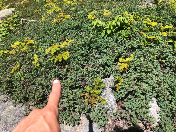
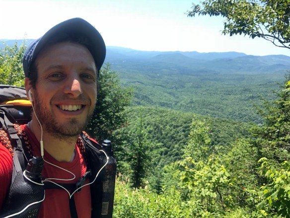
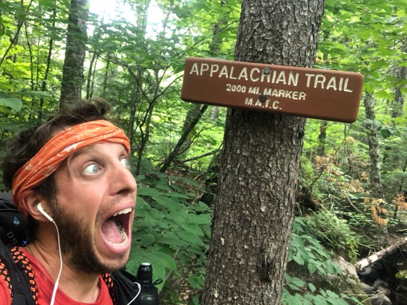
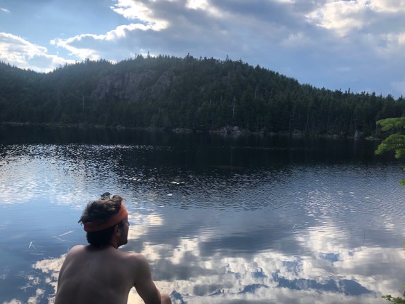
Day 134. Big day today! As you can tell in the enthusiastic photo above, someone has reached a big milestone on their Appalachian Trail journey. Spoiler alert, it’s me. Your humble and obedient blogger, Sharkbait, has officially put 2,000 miles under his feet on his way from Springer Mountain to Katahdin.

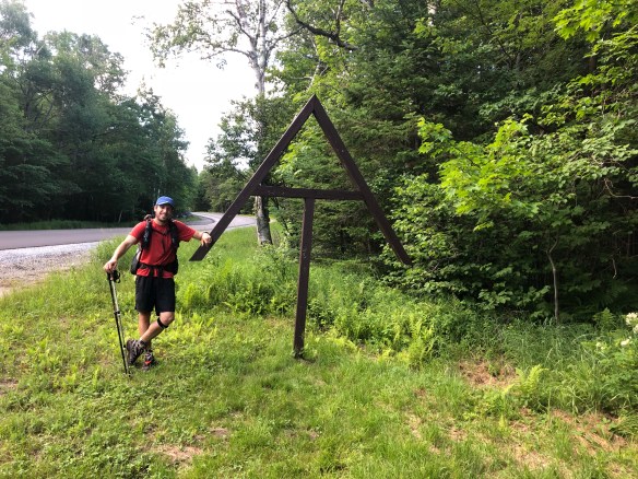
Ok, so that photo was actually closer to the 2015 mile mark, but no one had put sticks on the ground at the real place, and I forgot to do it too. So a few miles later, an old signpost did just fine to commemorate the moment for me.

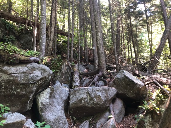
Today was a nice hike. Not as good as yesterday, as the open ridgeline walks were gone again, but still very pleasant. With a few exceptions, today’s trail was very well groomed. Wide, soft, and sans obstruction. There were a few steep areas on Crocker’s south and north peaks, and again coming up from the Highway 27 crossing into the Bigelow mountains, but nothing as bad as Maine gave me a few days ago (screw you, Moody Mountain!). Oh and the mosquitos were bad, but manageable.

Overall it was a pleasant day hiking. I opted not to go into the town of Stratton at the Highway, and instead hiked the 5 more miles up Bigelow Mountains to the Horns Pond Lean-tos. I didn’t need a hotel again so soon, and I’m good on food supply for a couple more days … but it was a hard temptation to pass up nonetheless.

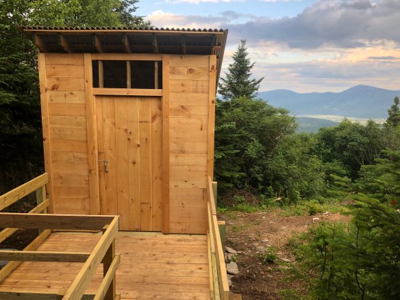
I arrived at the shelter area pretty early and was impressed with the condition. This campsite is huge, complete with 3 shelters structures, 2 brand new privies, and a half dozen tent areas next to a gorgeous pond. A caretaker stays here during peak season, and he/she has done a wonderful job with the whole area. There are even big plastic buckets with secure lids at each tent site for your food. No need to hang my food bag tonight, nice.

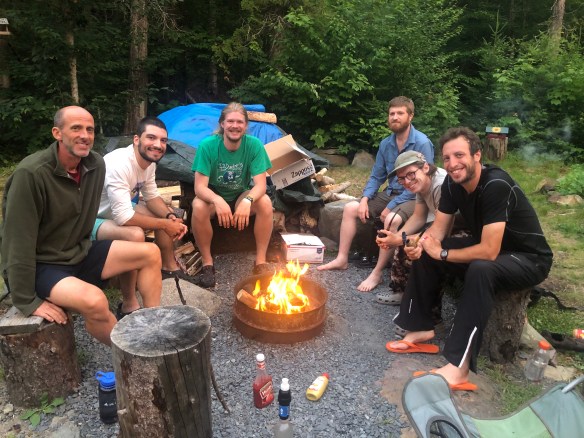
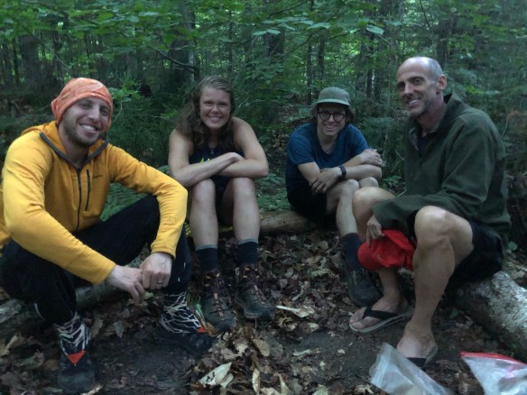
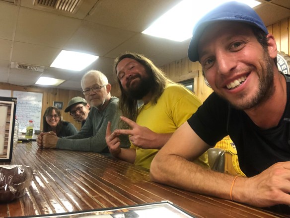
A few other weekend campers are here with me, and I sat at the Pond with them for a while when I first arrived. The 3 of them were very nice, and asked me many questions about my experience over the next hour. While chatting, I took a dip in the cool water, gave myself a much needed bath, then sun bathed on the rocks. It was, simply put, a GREAT way to end the day.

We then all ate dinner together, where I learned that they are part of a volunteer group that helps maintain the AT and it’s wilderness conservation in Maine. They had plenty of stories to share as well, and I enjoyed hearing about their passionate work to maintain these hiking lands as I ate. We also swapped animal stories. They liked my late night bobcat encounter back in PA.

I never did see the caretaker, but if I do tomorrow, I will commend him/her on the fine privy craftsmanship. These two pig toilets are immaculate. Shiny, odor-free, and overlooking an incredible view. Who knew a toilet could be so impressive!

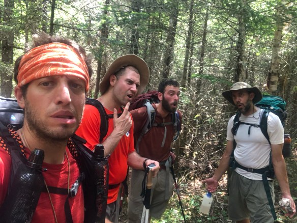
As it was still early, I worked on last week’s video after dinner. I know this one may be confusing to follow for those who didn’t follow along on the blog during the week … but hey, that’s not my fault. Sure I was in Gorham, then the AT, then back in Gorham, then back on the AT where the pictures left off the day before … but viewers will just have to read my story to learn why. (Answer: Appalachian Trail 1, My loyal Friends 0). I’ll try to post it tomorrow.

Tomorrow also brings the South Horn, Bigelow, and Avery Mountains. They look steep in my guidebook, but I already climbed up most of the elevation today. And I hear it is a lot of fine ridge walking again, so that sounds nice.

Oh, and no, I didn’t pee on that awful family last night. But in chatting with the other guy who tented in the area too … he agreed I should have.

… Ok, sorry to end on a scary note, but just as I finished typing this up, a search and rescue team walked into camp. It’s about 9:30pm, and apparently a hiker named Jennifer activated her SPOT device (emergency locator beacon) just north of here, near the top of South Horn. They were hoping for information from SOBOs, who may have last seen her. I stepped out to talk and help, but didn’t have much to offer. They thanked me for what information I could share (mainly that she wasn’t here and I hadn’t seen her), and continued on. It’s late and dark, and that’s a scary situation for an emergency in the woods, but I hope this hiker is found quickly and safely.

Hello Neiman (Sharkbait)!

  • Start Mile: 1989.2
  • Start Time: 07:40
  • End Mile: 2007.8
  • End Time: 17:10
  • Miles Hiked: 18.6
  • Miles to Go: 183.1
  • Lodging: Horns Pond Lean-tos

Day 133: Spaulding Mountain Lean-to

Day 133. Full disclosure, I finished and scheduled last night’s blog before I actually got back to the hostel. There was no cell service there, so I assumed I’d go right to bed after my outdoor shower. Not the case!

We had an awesome campfire until after 10pm, and it was fantastic! After my fun outdoor shower, a bonfire was lit by the guests. The owners of the hostel, Steve and Cathy, made popcorn for us, then brought out a guitar and asked if anyone played. I said I did and would be happy to play as long as people wanted, which ended up being late into the night. Besides me, there were 9 others congregating around the fire, and everyone joined in singing songs at one point or another. It was a perfect evening and one I’ll surely never forget. As I went to bed, Cathy joked that this hostel has always reminded her more of a rustic summer camp … being a camp guy myself for years, and still sitting at the fire, I told her I couldn’t agree more.

Side note, contrary to my confusion yesterday, Steve and Cathy do have a “home” on site. But it’s no more than a 1-room cabin next to the unattached 1-room kitchen. The whole property is just timyb1-room buildings and flower gardens . You can see their home in the pic below. From left to right is their bedroom, kitchen, hiker bunk house.

Then, guess what happened when I woke up this morning? I had the BEST day in Maine! It’s true, all the whining and complaining (mostly out loud to myself) the past week was all forgotten, as today brought a fantastic day of hiking again.

Beautiful trails, incredible summit views, a mile of gorgeous ridge walking in the sun, and even a waterfall. When I think back to this state of my journey, I know I’ll think fondly of today. Before lunch, I had scaled Saddleback Mountain, The Horn, and Junior Saddleback’s peaks … each providing breathtaking views in all directions. In fact, from the top of Saddleback, you could even make out Mt. Washington to the south and (supposedly) Katahdin to the North. I couldn’t see the latter, as it’s still 200 miles away … but they say it can be seen.

Some other fun anecdotes today. The Piazza Rock Lean-to privy had an interesting feature, so I learned. If you ever feel like pooping in the woods AND playing cribbage with a friend … this is the place for you! I’d love to meet anyone who actually attempted a game, haha.

Also, found some blueberry bushes on the summits today. They were not ripe yet, but they are getting close. Maybe a few weeks away from good fruit. Another alpine berry was starting to bloom there also, which may have been crowberries, but I’m not sure. I have only seen those in Alaska, but they looked and tasted close to the same. Don’t worry, they weren’t anything poisonous.

I also had a fun rest-stop at the Poplar Ridge Lean-to. This is one of the oldest shelters on the trail and is known for its informative binder of Q&As that accompany the registry. A volunteer built it up over his 50+ years of maintaining the trail in this area, and he had a good sense of humor. There are nearly 75 responses to hiker inquiries over the years, my favorite being #18 pictured below. Affirmative action mosquitos … brilliant.

Only a couple problem areas today. One was my 7th fall, which was totally my fault. I lost the trail (per usual) near the waterfall, and was using my Guthook app’s GPS to find it. But I was also walking, and I stepped on a loose rock, causing a rough stumble down the dirt hill. I scraped up my leg a bit, but nothing too serious. So, I yelled at myself (out loud of course), cleaned the leg as best I could in the stream, and hiked on.

The other annoyance today came at the end. When I arrived at the Spaulding Mountain Lean-to, another group of teenage girls were here. A different group than before, but still annoying as they took up all the camping areas in front of the lean-to. But that wasn’t the worst of it, I found a secluded place to string up my hammock about 50 yards behind the shelter and then went to get water. When I came back, a loud and obnoxious family of 3 had decided to setup their tent RIGHT NEXT TO ME.

I mean, come on. There were at least a dozen other tent sites between me and the shelter. Why go next to me?? And I’m not kidding, their tent is literally 3 feet from the end of my hammock. When I walked up, they jokingly said, “we hope you don’t mind, we couldn’t find another place.” I thought to myself, that I would be happy to find them one … most likely in the creek, where I wanted to throw their tent (with them inside) into.

I’m a nice, inviting, friendly and social guy … but this is seriously invading my personal space. They loudly ate their dinner on a log between our tents (no joke, 1 foot away from me) and then loudly “went to bed”. I write that in quotes because they proceeded to talk, giggle, bicker, and make loud movement noises on air mattresses for the next 2 hours. I can hear every word of their conversation, and every breath they exhale as I write this.

A really crummy way to end such a nice day. I was wrong to think that teenage girls would be the problem here. This married couple with their 25 year old daughter all sharing a small 3 person tent, close enough for me to pee on them, are. Hmm, maybe I should do that. A little late night revenge pee? It’s better than my other dark homicidal thoughts right now…

Hello Neiman (Sharkbait)!

  • Start Mile: 1970.5
  • Start Time: 07:30
  • End Mile: 1989.2
  • End Time: 18:10
  • Miles Hiked: 18.7
  • Miles to Go: 201.7
  • Lodging: Spaulding Mountain Lean-to

Day 132: Rangeley, ME

Day 132. I awoke this morning very rested. I usually have a good night of sleep when in my hammock, but last night was especially comfortable. It may have been the hot dogs last night, it may have been the soothing river sounds, but I slept like a baby. I did hear something big clomping around the campsite just before bed though … moose again!

In the morning, I had a quick, cold breakfast and then headed out for the day. I only had to get to the town of Rangeley by 4pm, 14 miles away, so it wasn’t going to be tough. After a mile or so, I got a nice glimpse of Rangeley on its lakes in the distance and took a photo (below). The next 4 miles were very easy, as a soft and wide trail wove around the massive Moxie and Sabbath Ponds to a lean-to on the other side. At the shelter, I had my typical morning snack (trail mix, snickers, fruit leathers), filled up on some water from the lake and then headed out again.

The rest of the day was equally nice terrain. I traversed a couple hills so small that they didn’t have names, and eventually made it to another big lake called South Pond. I noticed a few cabins sprinkled along the edge of the ponds today, which I thought would be nice to own for someone who lived up here. If I could drive to a house on a secluded lake, I may appreciate Maine a bit more.

The only real problem today was the bugs. Although not terrible, I combatted mosquitos and horseflies most of the day that were attempting to harvest their winter blood stores from me, and most were successful. It was a hot day again so my DEET kept sweating off, but I managed to survive with the help of my head net and arm sleeves. With all the stagnant lakes and creeks in this part of Maine, that may become daily wardrobe going forward.

I arrived at the highway to Rangeley at 2:30, with plenty of time to spare. It’s 20 miles to town, and not a great location to attempt to hitch, but about 1/5 of a mile up the road is a hostel called The Hiker Hut. Besides being a way to get a ride to town, this hostel is also a very unique place to stay. As they describe themselves, the Hiker Hut is a “restful sanctuary along the Sandy River with flower gardens, hummingbirds, and pet chipmunks”. It is more like a tiny community than a hostel. They have a property of land with gardens and decorations all over, a bunk house, a couple private cabins, an outhouse, and an outdoor propane-heated shower … but not much else. No plumbing, no electricity, no cell service, nada. I assume the two caretaker/owners have a house on the property somewhere too, but I did not see it. I did see a tent at the entryway … perhaps they live in nylon year round? I’ll have to ask tomorrow. I arranged for a bed in the bunkhouse at $25, which also gets me a free shuttle to town, shower, and laundry. Then I hopped on the 3pm shuttle to downtown Rangeley.

Rangeley is a “big” tourist town, and it was crowded. They have a couple outfitters, restaurants, ice cream shops, and gift shops to accommodate all the hikers, skiers, bikers, and kayakers that come through each weekend, and all were packed today. I grabbed an early dinner with Much Obliged at a sports bar, enjoyed an ice cream shake (below), then watched some ducks floating on the lake. It was peaceful and relaxing, even if in a bustling trail town.

The shuttle came back for us at 7pm, which was much later than I would have liked. But without cell service, there’s no way to call and ask for an earlier pickup. I suppose I could have hitched back, but didn’t see a strong need. I took a late shower, hopped in bed and called it a night. The next 3-4 days are supposed to be tough, with some steep 4k peaks to get over (Saddleback, Spaulding, Crawford, Bigelow). But after that it should be smooth sailing. I’m on a tight schedule now, so no more Zero days or Nero days if I want to make it to Katahdin by the 24th.

Hello Neiman (Sharkbait)!

  • Start Mile: 1956.5
  • Start Time: 07:35
  • End Mile: 1970.5
  • End Time: 14:30
  • Miles Hiked: 14.0
  • Miles to Go: 220.4
  • Lodging: The Hiker Hut

Day 131: Bemis Stream

Day 131. I heard a joke on the trail today which (although crude) sums up my feelings of the hike these past couple days. “Maine is like a woman you meet online … she’s pretty in pictures, but a b*tch in person.”

Sorry if that offends anyone, but damnit if it isn’t true about these mountains; and to be fair, a woman told it to me.

But seriously, Maine is no cakewalk! For 3 days now, it’s been severe PUDs (pointless ups and downs), with minimal views that no sane person would seek out for casual pleasure. They have their moments, sure (mainly the small summit areas, when above treeline), but the effort required to get there is so significant that you barely want to enjoy it.

I fell again today, my 2nd time in as many days (and 6th time total). And I have rolled my ankles in painful missteps more times than I can count within the past week. I am lucky my feet are in such good shape, with strong muscles surrounding those weak ligaments and tendons … any one of the dozen twists I incurred today would have likely sidelined my hike for weeks of recovery if it happened back in Georgia. I’m thankful that I’m hiking this section now, and not first, like a Southbounder. The few clearings I did come upon today were spent trying to catch my breath, massage my feet, and eat as much fuel as possible. It was not a horrible day, but it definitely wasn’t easy.

But, on a pleasant note, my hike today began nicely, with an easy 6 mile climb up Wyman Mountain. Gandalf (the one I’ve seen off and on since Lincoln) shuttled back to the trail with me from Pine Ellis Hostel, and we hiked those slowly ascending miles in just 2 hours to the Hall Mountain Lean-to. That was a speedy 3mph, and felt great on the body. After a snack and drink at the Lean-to, we hit the trail again and I immediately fell behind. Granted, he is 20 years old and has more endurance than me … but that wasn’t the issue. Moody Mountain and Old Blue Mountain were, with their near crippling climbs of death defying rock climbing.

Seriously, who maintains the trail up here?? I spent the next 3 hours pulling myself up at least 60 degree embankments that practically required climbing ropes and carabiners. Some had rock steps built up the cliffs, others had rebar drilled into them, but most of the next 4 miles was just trees to grab hold of. I walked more than 20 miles today, but this was more of an upper body workout than my typical leg day.

And at the top? Nothing. Moody was tree’d in completely, and Old Blue had one small rock clearing infested with horseflies. No reprieve there, just a moment to yell, swat, slow my heartbeat for a few minutes, and then move on.

Speaking of yelling, I keep forgetting to mention this fun fact. Since Massachusetts, I’ve noticed I now talk to myself. Out loud. A lot. It’s nothing weird, but when I do something dumb or take a bad step, I yell at myself or the trail. Or, on the positive side, if I see something nice, I mention it to myself. I sing out loud more, I ask questions (“why did you step there if you knew it was a loose stone?!”), and even talk to the animals if the moment is right (“hey bird, I like your song” … “sorry squirrel, didn’t mean to scare you.”)

I am not crazy, I just like the sound of talking where it would be expected in normal life. And if no one else is there to give it, I guess I need to provide both sides of the conversation aloud. I don’t even realize I’m talking until afterwards. And then I usually follow it up with a statement chastising myself for doing it (also out loud). Ok maybe it is weird, but I can’t really control it anymore. I guess it’s just a part of the magical transformation your body and mind go through after hiking alone for 4 months.

Had a couple great moments today too. The negative stories are more dramatic, and thus make the blog more interesting, but there’s always good stuff happening daily as well (if there wasn’t, I wouldn’t be out here!).

First off, I finally saw a moose! Not a dead carcass, like the skeleton I saw a couple days ago, but an actual live moose. It wasn’t very large, and was high atop Bemis Mountain, just before the crowded Lean-to. I startled her, and she ran up the ridge away from me before I was within 50 feet, but she was initially just chilling on the trail. I wasn’t able to get a photo, but it was very neat. Finally my animal sighting bingo card is complete.

Then, coming down from Bemis, just before the creek … trail magic! It was late, after 7pm, but Gandalf had told them I was coming so they waited for me too. Snowman and Teddy were the kind couple who fed us, and soon my gut was filled with hot dogs, bananas and soda. It was actually a big party, as Gandalf, Much Obliged, Treeline and Grits were all at the dinner feast as well. The hosts told us they drive up to this trail crossing (Bemis Mountain Road) twice a week all summer long, from over 70 miles away! They are incredibly caring and generous, and simply love to help out hungry hikers. I’ll say it again, the AT has the BEST community of support!

After that, the 5 of us hikers all headed to a big stealth campsite on the other side of Bemis Stream. Normally this is a river that requires fording, but it was easily crossable today on the rocks. Which was nice, as I didn’t want to end my long day with wet feet. Then we all quickly set up camp, hung our food bags (no one needed to cook dinner tonight!) and chatted into the evening. All of us are old friends by now, having spent multiple evenings camping together at one time or another this past month. Gandalf taught me a new trick to packing my pipe so it burns better, and we all watched and learned with amazement to see it actually worked. That 20 year old kid has a few old man tricks up his sleeves.

Side note, this was maybe the 4th time I’ve used it. A nice luxury item that has collected dust most of the trip.

Going to bed tonight by the river is great. It was a very hot day and I needed a sponge bath bad. It’s also great to have a crew with me here, as I like the company, especially in an area where I’m sure moose or other animals frequent at night. And best of all, I have the soothing sounds of rushing water to ease me to sleep. I guess Maine isn’t so bad sometimes.

Hello Neiman (Sharkbait)!

  • Start Mile: 1934.0
  • Start Time: 07:25
  • End Mile: 1956.5
  • End Time: 19:45
  • Miles Hiked: 22.5
  • Miles to Go: 234.4
  • Lodging: Bemis Stream Stealth Campsite

Day 130: Andover, ME

Day 130. Had a great day today. It was a short day, as I decided not to alter my original plan of stopping in Andover, even though I just had a hostel stay 2 nights ago. But I had to come in either way to get my resupply box, so I made it a casual 8-mile Nero Day and took my time both getting up and hiking.

There were some rough mountains today though, as Maine continues to show off it’s treacherous climbs and steep summits. Baldpate Mountain’s West and East peaks were way up there. Following yesterday’s crazy climbs, this was not too hard, but it was seemingly non-stop for miles. I felt like I was climbing up the largest rock in America. Not rocks, rock. It was like one giant rock 3,800 feet high and smooth as a baby’s bottom on both sides. Not the easiest hiking, as that makes for more of the sheer/steep trail I rue, but it was at least above alpine line for a long stretch that gave breathtaking views of the surrounding mountains.

After the summits, the trail followed a stream down towards Dunn Notch, which created some excellent waterfalls and swimming holes. I arranged for a ride to town from a dayhiker I met early in the day, and knew I had a couple hours to kill before she would reach the parking lot at the bottom. So I decided to take a short side trail (0.2 miles) to Upper Dunn Falls, a hidden gem of a swimming hole that resembles something you’d see in the movies. I hadn’t seen many people today, so was looking forward to a private dip in the cool water while basking in the hot sun. As I approached the hidden falls though, I heard the most disheartening sound a 37 year old man could hear in this setting … teenage girls. A troop of 15 or so middle school aged girls had all dropped their backpacks and had taken over the creek with their screams and giggles.

Being wise enough to avoid that scenario at all costs, I made an immediate u-turn and went back to the AT’s familiar white blazes. I followed the creek a mile further to the road, and was pleased to find another awesome swimming spot waiting for me just before the end … and this one was empty. Score! I dropped my back and sat in the cool water for a spell, letting the day’s pain wash away with a huge smile on my face. Here’s a pic of my special place.

After drying off, I went up the parking lot and road. While waiting for the dayhiker to arrive, a truck drove by and offered me a lift to town. Preferring not to wait another couple hours, I hopped in and thanked the driver for the offer. He took me to downtown Andover 8 miles away, which is a 1/2 block stretch of 4 or 5 buildings, but ripe with good food offerings. I had lunch at a really nice place called the Red Hen, then walked to the hostel down the road.

The Pine Ellis Hostel in Andover is an interesting place. Not bad, per se, but I’m also not sure I would recommend this to too many other hikers either. The house is old, with a lot of old signs and rules, but the bedrooms and beds are nice, clean and comfortable. However … if they tell you that the only available beds are in the rear overflow bunkhouse, keep walking. That is a converted garage that smells like mildew and looks like a murderer’s workshop. You can do worse (The Dungeon), but you can DEFINITELY do better.

Other than that, the hostel is fine. They charge a lot for shuttle rides to Walmart or the trailheads, and the 4 elderly people jointly managing it are a bit odd, but also very friendly. There is a nice porch out front where we all sat, enjoyed a few beers, and compared strategies for the next few days. I am a bit behind schedule, but think I can make up a day easily before the 100-Mile Wilderness (assuming I don’t lose a day for storms or other unplanned reasons). #fingerscrossed

A big group of us are all in town, most here with me, but others also tenting for free behind the Red Hen restaurant. About 8 of us in total. We all went to dinner together at the small diner inside the General Store, taking up the whole bar area available, then all retreated back to our alerting quarters. After doing laundry and organizing my resupply box, I’m going to get to bed early now. I want to try for at least 20 miles tomorrow, so scheduled a 7am shuttle in the morning.

Hello Neiman (Sharkbait)!

  • Start Mile: 1926.0
  • Start Time: 07:45
  • End Mile: 1934.0
  • End Time: 12:05
  • Miles Hiked: 8.0
  • Miles to Go: 256.9
  • Lodging: Pine Ellis Hiker Hostel

Day 129: Baldpate Lean-to

Day 129. Another visiting group has come and gone, and I’m back on the trail alone. I’ve been so fortunate with the friends and family that were willing and able to join me on my hike, it truly has made a world of difference to enjoying this adventure fully. I may possibly have company for Katahdin, but otherwise I’m hiking solo the rest of the way, and although all my guests were fantastic, I’m also looking forward to enjoying the solitude and camaraderie of other thruhikers over these last 3 weeks.

Speaking of other hikers, man I’m seeing a lot of them lately. Mostly Southbounders, whose bubble I appear to now be in. I met at least a dozen thruhikers going south today! It’s funny to think they are just starting, while I’m on the home stretch with the end in sight. Almost makes me want to turn around and hike back to Georgia with them after I finish!

Getting back to the trail wasn’t too bad today. The rental car could just barely handle the paved logging road at 15 mph, but my friends got me within a mile of the Carlo Col Trailhead around 9am. It ended too quickly, but it was a great 3 days with Los Tres Gatitos. We said our goodbyes and then I headed back into the woods again.

The weather today is perfect. High 60s and sunny, with minimal wind. I didn’t necessarily need to hike as far as I did today, but it was so nice I enjoyed the additional time on the trail. It took me about an hour to hike the 3 miles back to the AT, and I marveled at how much lower the creek was from yesterday. There were st least 3 places where crossing caused severe wet boots 24 hours ago … but now, not a one. I bounded back up the mountain in an hour and was putting official miles under my feet by 10am.

The trail was decent today, with great views, but with a ton of steep climbs to get to them. Many areas had ladders or steps drilled in the rock to help you scale the boulder faces safely, and it was slow going at first. But eventually I put Mt. Carlo, Fulling Mill Mountain, and all 3 summits of Goose Eye Mountain behind me.

Then it was time for Mahoosic. The dreaded, scary, deadly, Mahoosic Notch and Arm.

Which, ended up being nothing dangerous at all and just a really nice hike! The Mahoosic Notch was a ton of fun, as I maneuvered through the giant boulder field with care and ease. This Notch is so unique in that it’s trapped in a low valley with limited access to the elements. The temperature is much cooler, with chilly air coming up from below the boulder field, and ice cold water pouring out to drink from in some areas. Seriously, it was the coldest water I’ve had on the whole trail, and it was spectacular. There were even patches of snow on the ground in areas that clearly never see the light of day! They say this is the toughest or most fun mile of the trail, and it was definitely the latter. It took me an hour to get through all those crevices and tunnels, but I loved it!

Still, it would have been much harder and dangerous if wet, so I agree with all the recommendations of waiting out bad weather and doing this section on a dry day … as well as the mountain (Mahoosic Arm) that follows.

The Arm is another steep super climb up to a summit, lined with sheer rock slabs the whole way. It is so steep and smooth that it would be near impossible if wet, so I again secretly my friends for their desire to avoid it yesterday. Instead I got to enjoy it comfortable today, and enjoy it I did. The views at the top were amazing and well worth the challenge.

After that, it was a slow and steady walk down to Grafton Notch, where I just missed a chance at trail magic. Passing SOBOs gave me the heads up of the awaiting food, but I must have arrived too late, as nothing was there. Oh well, this was a nice day, so I didn’t feel the need for any magic anyway. There was a huge wooden AT symbol on the road though, which was a neat surprise, so I took a photo (above). Also, I was offered a can of beer from a dayhiker earlier as well, so I had that to look forward to with my dinner later.

After a few more miles uphill, I arrived at the Baldpate Lean-to. In Maine, they call them Lean-tos instead of Shelters for some reason, though the setup is exactly the same. Only difference is the name, which is odd. Much Obliged is here at the Lean-to, as is another NOBO I’ve heard about named Manimal. That guy is a character, I’m glad I met him as he is a fun storyteller and goofy guy. There are others here as well, but none I know by name.

I made up some miles today from this past week’s double audible, but I’m still 8 miles behind schedule. Easy to make that up, so I’m not worried. My estimates have me summiting Katahdin exactly as planned on the 24th, but I’m thinking I will likely shave a day off my plan in the upcoming 100 mile wilderness. So it’s more likely I’ll arrive at Baxter State Park the evening of the 22rd. This is good, as it gives me a couple chances to hold out for a beautiful day for my final climb up the northern terminus. Fingers crossed for a good weather day!

Hello Neiman (Sharkbait)!

  • Start Mile: 1909.6
  • Start Time: 09:00
  • End Mile: 1926.0
  • End Time: 19:40
  • Miles Hiked: 16.4 (+3.0)
  • Miles to Go: 264.9
  • Lodging: Baldpate Lean-to

Day 128: Gorham Zero Day

Day 128. Although I technically hiked 3 miles today along the Carlo Col Trail to the Success Pond Rd, those don’t count towards my AT completion. Since my total miles (that count) are zero, I guess today was a Zero Day. But that’s just fine, as we typically have a day of goody town hijinks on our adventure trips anyway.

We woke up this morning to the anticipated rain and thunder around 5am. It didn’t last too long though, clearing up around 10am. We arranged a shuttle to get us at noon and then headed down the blue blaze trail. However, after a few hours of rain, it was completely different than what Max and I recalled from our reconnaissance walk the day before. This trail follows a creek downward, and the lower we got, the faster flowing and river-like it became. Where we never had to cross anything under water before, we now had multiple areas that forced us into ankle high water. It’s amazing how quickly the creeks rise here! No leisurely stepping over rocks this time, instead we had to ford the river in a half-dozen places (photo above).

The trailhead empties out on an old logging road, barely accessible by car and not heavily maintained. It had gravel paving, but not much. The shuttle was able to get through to us, but we had a slow commute back to the Rattle River Hostel, with lots of pothole swerving and off-road-like maneuvering. It was fun, and tomorrow I’ll need to take it again to get dropped back to where I left off.

We were back by 1pm, so we went to explore the town for the rest of our day. This provided us with a great lunch from a BBQ food truck, a round of made-up frisbee golf, a round of real miniature golf, and dinner at an amazing restaurant. Saalt is its name, and it is incredible. The head chef (Liz) trained under Julia Child, and has a menu that is truly Michelin restaurant worthy. I will never be back here again, but that 40-ingredient lasagna is almost worth returning. Yum!

After dinner we went back to the hostel and played a rousing game of Settlers of Catan, hung out with the other hikers, organized gear for our early morning departure tomorrow, and then crashed. These guys are flying home tomorrow, so they won’t be able to hike the Mahoosic Notch and Arm like planned … but I don’t think that bothers them too much. We had a great time hiking what we did together, and I’m once again reenergized to keep on and reach the end. Almost there!

Hello Neiman (Sharkbait)!

  • Start Mile: 1909.6
  • Start Time: 10:00
  • End Mile: 1909.6
  • End Time: 12:00
  • Miles Hiked: 0.0 (+3.0)
  • Miles to Go: 281.3
  • Lodging: Rattle River Hostel

Day 127: Carlo Col Shelter

Day 127. Well, today went a bit differently. I’m not sure if the trail was significantly worse for them, or if the guys were too worn out from yesterday’s hike, but we didn’t go far today. The main obstacle of the morning was Mt. Success, a 3,500 foot mountain with some pretty steep sections of climbing. We reached the top sometime around noon, meaning our pace was a slower 1 mph compared to yesterday’s 2. We were still a couple miles from our mid-point of today’s hike though (the Carlo Col Shelter), so I pushed the crew further and we eventually reached the campground at 2:30. Then we discussed our situation, everyone’s feelings, and our options.

Side note, we crossed into Maine after coming down Mt. Success! I didn’t realize it at the time and didn’t see the signpost calling it out, but I’m officially in my final state and on my way to Katahdin. Woot!

The fatigue in my friends faces was a bit worrisome. We still had plenty of time to hike the 4.5 miles to the next campground (Full Goose Shelter), but the weather was becoming more of an issue as well. The heat was intense, the steep rocky sections were slow-going, and thunderstorms were on the horizon. With 3 more climbs up Goose Eye West Peak, Goose Eye East Peak, and Fulling Mill Mountain still to come in the day … the crew decided to audible the trip again.

On my own, I would not be as concerned, but there were two real problems with visitors to the AT that concerned me:

First, if we go on, we start tomorrow’s hike with Mahoosic Notch and the Mahoosic Arm. The Notch is considered the “hardest mile on the AT”, as it requires maneuvering under, over, and through giant boulders at a snail’s pace. You literally have to throw your poles and bag through a narrow rock gap, then squeeze yourself through, then slowly navigate to the next hole. It’s a 0.8 mile section that takes thruhikers an hour to complete, in good conditions. Following that, is the climb of Mahoosic Mountain known as the Arm. This is one of the steepest climbs, as the trail rises 1500 feet in 1 mile. I’ve read countless stories of hikers breaking bones, getting lost, and even dying in this section of trail in bad conditions. There is no phone service if needed, and no exit point to civilization if something goes wrong. Doing this trail if it has rained in the past few days even, creates a water slide of life-threatening proportions. And we have 90% chance of rain and thunderstorms from 5am to 2pm tomorrow.

Which brings up fear #2, if we don’t make it over the Arm and down the steep descent to Grafton Notch at the bottom, we may not have another way to get off the trail. The guys all have flights to catch on Saturday and we need to get them back to the car in Gorham by tomorrow night. With the change in pace today, I’m finding it hard to believe we could finish the 4.5 miles today and have much left in the tank to do the 10 tomorrow needed before dark. It’s obviously doable, but adds significantly more risk.

So, with those very real concerns in mind, we discussed our situation, options, and preferences. I won’t call anyone out, but let’s just say some of us wanted to take on the challenge while others wanted to avoid widowing their wives. We scouted out a blue blaze side trail that leads from this shelter off the mountain and made the wise decision to stay here tonight, hike out the 2.5 miles from here in the morning, and get picked up at the trailhead below.

In truth, this was a smart decision, but also an enjoyable one. With a whole afternoon together sans-hiking, we hung out, caught up on each other’s lives, went for a swim in the river, and ate dinner in comfort. We then stayed up late into the evening storytelling and laughing with Gandalf and Much Obliged who wandered in later. We stayed up until nearly midnight (another record for me on the trail) and I spent the final moments lying in front of the shelter just staring at the stars. It was a nice Nero Day for me in the woods, and none of my friends died on the trail … win win.

Hello Neiman (Sharkbait)!

  • Start Mile: 1904.4
  • Start Time: 09:00
  • End Mile: 1909.6
  • End Time: 14:30
  • Miles Hiked: 5.2
  • Miles to Go: 281.3
  • Lodging: Carlo Col Shelter

Day 126: Gentian Pond Shelter

Day 126. What a great day. After the sh*t show of yesterday, with all it’s painful falls, today was a cake walk … for me, at least. For my faithful friends, perhaps not so much. When asked how difficult this section of trail was, I told them it was extremely nice. With 10 being the hardest, it was a 2 or maybe 3 out of 10. Seriously, after what I just finished in the Whites, today was amazing. When I asked Aaron the same question back, he replied “this is the hardest hike I’ve ever done”. So, yeah, there’s the AT in a nutshell for ya…

I loved today. And I am extremely impressed that my warrior crew of hiker friends that have traversed Glacier Park, Yosemite, Denali, North Dakota, and more were able to join survive hiking the AT with me (so far). We knocked out a fantastic section on some beautiful trails, speckled with rocky ups and downs of course. But we ended at a gorgeous campsite next to a lake, high up in the mountains with a clear view to Independence Day fireworks going off in the town of Gorham, 12 miles away.

The weather was hot, surpassing 90 degrees at the day’s apex, but the shady cover of the green tunnel protected us and provided cool air for the majority of the day. The summits at Mt. Hayes and Cascade Mountain were spectacular, providing clear views from high up to the White Mountains in the south, in a dazzling display of blue skies and golden sunlight. They were tough for my comrades though, so we rested often, drank lots of water, and kept a slow and steady pace. Actually, our pace was close to 2 mph, so not even that slow. Like I said, good terrain and great day!

When we got to our campsite at Gentian Pond Shelter, Max and I scrambled up a side trail rocky cliff to a plateau area overlook, and searched for a stealth campsite there we could all enjoy. Unfortunately, it was too small for 4 people so we moved over to the tenting area of the shelter.

Side note, I highly recommend solo hikers scramble up to enjoy that stealth spot, it was awesome for one tent or hammock.

These are elevated wooden platforms for camping next to the shelter, so we picked one of those for camp instead. Adam and Aaron set up their (very small) 2-person tent for the night, while Max and I hung our hammocks from fir trees next to it. We spent the rest of the night enjoying a lot of great conversation, food, whiskey and laughs. I haven’t stayed up past 10pm in months, and as tired as we all were after 8 hours of hiking … it was totally worth it.

The 3 of them … whose temporary trail names are the collective “Los Tres Gatitos”, wanted to write tonight’s blog. But after a hard day of hiking and a hard night of drinking, their journal entry dreams slipped to instead being a quick Siri-dictated string of anecdotal one-liners expressing their inner-most thoughts and vague memories. I have a feeling we’ll add these to the end of each night’s post while they are out here, as it’s pretty funny to watch in person. Here’s their own words to describe the first day of their AT hiking experience…

An oral dictation of the day’s events, as transcribed from Los Tres Gatitos…

  • It was a 3 out of 10 for some but a 12 out of 10 for others.
  • Blisters rampant on us, but Mike was a stud
  • Their were too many things to carry and only one solution presented itself, give it to Mike
  • I didn’t know we were going to hike through Degaba
  • We looked for wildlife but only saw one very impressive thing
  • Lots of horse flies
  • Aaron’s heart nearly exploded, flew out of his chest and landed on the trail
  • We had to execute an emergency medical procedure
  • My toenail is near falling off
  • Also, Max has slightly less skin on his head than when he started
  • Luckily there is not much blood flow through there
  • But sitting here looking at the stars, drinking whiskey, and hearing fireworks in the distance makes it all worth it
  • Happy Fourth of July y’all
  • Peace out

Hello Neiman (Sharkbait)!

  • Start Mile: 1892.6
  • Start Time: 08:30
  • End Mile: 1904.4
  • End Time: 18:30
  • Miles Hiked: 11.8
  • Miles to Go: 286.5
  • Lodging: Gentian Pond Shelter

Day 125: Gorham, NH

Day 125. I am so happy today ended at a hostel, because that hike sucked. I was so proud of the fact I had only fallen once so far on this journey, back in North Carolina, but not anymore. Today I fell 3 more times, and all 3 were very hard and very painful falls coming down Mt. Moriah. One minute I’m slowly walking down a sheer and wet rock slab, the next minute I’m lying down on the ground. It was the Mt. Mariah Massacre. Fortunately, the only thing broken was a hiking pole and the only thing bruised was my ego … but the pain is all over.

The broken pole threw my rhythm off, which is likely why I fell two more times. But the steep, smooth, wet boulders called a trail aided heavily as well. It was just a combination of too many hazards at once, and weary legs that simply had been beaten and battered for too many days in a row without rest.

I loved the White Mountains for their beauty, but I hated their terrain. With such dangerous and difficult hiking this past week, I’m honestly glad to be done with them and move on to what’s next. Nice huts, nice views, awful hiking. My video above is full of smiles and jubilation, but don’t let that fool you, I was not always a happy camper at the end the day. And if not for stopping at a town and hostel today, I would be another unhappy camper tonight.

Fortunately, I did get to recover though, and at a great place. The Rattle River Hostel is a very nice and well-managed hiker B&B right on the trail in Gorham, NH. After the Mt. Mariah Massacre, I needed a shower and bed and I got both. In truth, the last 2-3 miles were quite nice on the AT, but I was checked out mentally by this point and didn’t stop to enjoy the well-groomed trail, the river flowing next to it, nor the inviting swimming holes within it.

I JUST WANTED A DAMN SHOWER.

For 3 days straight, I had sweat completely through my hiking clothes, and I smelled awful. You know it’s bad when you can’t stomach your own stink. The hostel owners must be used to this by now, as the entry room has a shower in it, and you must clean up before going further inside the house. It felt great.

For the next couple hours, I got to work fixing my gear. I called LEKI to get a free replacement part shipped ahead to me on the trail, then soaped up my sleeping pad to find the bubbly sign of the hole. Both problems now appear to be fixed, which is a relief. Then I worked on the above video and lounged in the yard waiting for my friends to arrive. If I didn’t have people coming to hike with me here, I’d definitely take a Zero Day. I think most people do.

Side note, I caught up with some old friends here! Charley Horse, No Need and Mr. Perfect all zeroed here today. I haven’t seem them since Massachusetts.

Around 4:30, a rental car pulled up, and 3 of my hiking buddies from Minnesota piled out. We 4 did a weeklong backpacking trip in Alaska a few years ago, and I am so happy they could come join for this adventure too. We did a quick Walmart run for me, then had dinner in town (Mr. Pizza, excellent food), and capped off the night with some beers and strategic planning. The next 3 days are going to be difficult, as southern Maine is also no joke, but they are up for the challenge.

Side note, less than 300 miles to go. Woot!

Hello Neiman (Sharkbait)!

  • Start Mile: 1880.0
  • Start Time: 06:45
  • End Mile: 1892.6
  • End Time: 13:50
  • Miles Hiked: 12.6
  • Miles to Go: 298.3
  • Lodging: Rattle River Hostel