Day 57: Johns Hollow Shelter

Day 57. Hiking is weird sometimes. I’m nearly 2 months into this trip and have not had a single blister. Then today, I wake up, start hiking, and instantly realize I have 3 at once. Arg! I know it is likely due to the continuous rain and wet feet since Daleville, but it’s extremely annoying nonetheless. All 3 are on little toes, spread between both feet, so it was pretty uncomfortable hiking throughout the day.

Time wise, I could have made the 25 mile option for today, but when I reached the shelter at 16 miles, my little piggies told me they were done. I tried treating the toes at lunch, to cover the hot spot before it turned blister, but it was already too late for that, so they just continued to pain me all afternoon.

I got to Johns Hollow Shelter around 2pm, and instantly soaked my feet in the nearby stream. That felt fantastic! Then after some careful cleaning, I did my best to treat the blisters fully (pop, drain, bandage, etc.) and pray it will heal up by morning. I have 20 miles to do by 5pm, so I can’t be limping on sore toes the whole way!

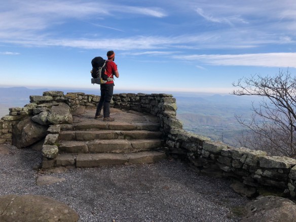
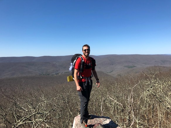
Besides that though, It was a gorgeous day. A full day of blue skies and sun while hiking in the James River Face Wilderness. Many stream crossings and just a couple big elevation changes meant it was a fairly simple day of hiking. One nice view came at Thunder Ridge Overlook, where I snapped the photo above. Even with foot pain, today’s hike was a good one. And it finally emptied out on the massive James River. Not the prettiest of waterways, with its murky brown water, but a big river and big landmark. After crossing the HUGE foot bridge, I was nearly done for the day.

Oddly, I didn’t see too many others today. I only shared last night’s shelter with one other person, and he left before me in the morning. I had a short chat with one of the local Ridge Runners (trail maintenance volunteers), and another with a day hiker sitting by a stream, but that was it. Looking at the registries in all 3 shelters I passed today, I realized I don’t have many people within a day or 2 of me … and of those that are ahead, I have no idea who they are. Up until now, I’ve always recognized names in the registries from earlier days on the trail together, but I seem to have passed just about every name I know, and am now chasing the hikers who started weeks before me or after. It’s an odd feeling for some reason, makes me feel just a bit more alone. But that’s alright of course, it just means there are new people to meet.

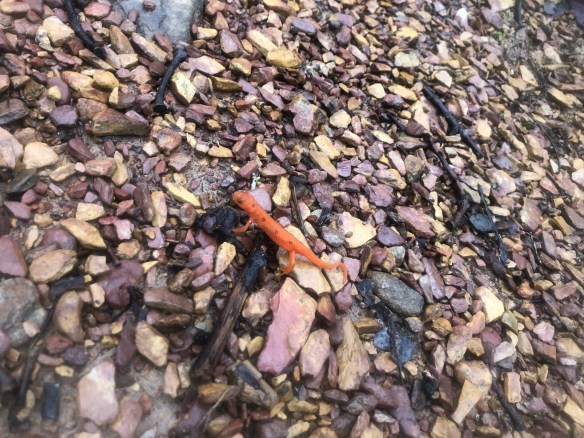
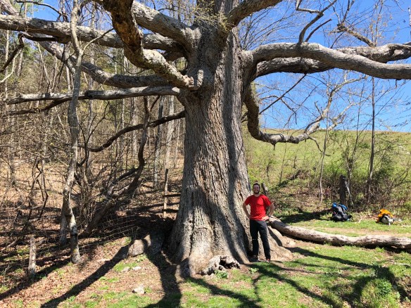
I saw a lot of cold blooded wild life today, which was pretty neat. There are these tiny orange salamanders, about 2-3 inches long, that have been out the past couple days. They are incredibly beautiful but strange out here against the constant green/brown backdrop. I also saw countless lizards, each about 6 inches long and more of a prototypical looking mini reptile. I saw a giant bullfrog hop along the trail in front of me … and I saw my first real snake. Not the tiny garter snakes that scurry into the brush as you approach, this one was the real deal. It was about 4-5 feet long, and all black. It hissed peacefully at me while slithering around Matt’s Creek Shelter, clearly letting me know this home was his … and I was welcome to visit it, as long as I kept my distance. I don’t know much about snakes, but in doing some research on the snakes of this region, it appears to have been a Black Kingsnake. Harmless to humans, but big compared to others, and it has an awesome name. If I wasn’t already Sharkbait, I’d like to be called Kingsnake.

After crossing the James River Bridge, it was a brief 1.5 mile hike uphill to the shelter. I laid out my pad and quilt in the shelter one more time because rain is coming tonight. I’m getting more comfortable sleeping in these things, especially if it means my gear stays dry. It appears I’ll be alone here for the night … a first for me on the trail. Tomorrow I’ll tackle the 2,000 ft climb of Bluff Mountain before heading back down to meet my family. It should clear up by late morning, and if the toes have heeled a bit, should be a great hike with epic views.

Hello Neiman (Sharkbait!)

  • Start Mile: 771.4
  • Start Time: 08:30
  • End Mile: 787.7
  • End Time: 14:10
  • Miles Hiked: 16.3
  • Miles to Go: 1403.2
  • Lodging: Johns Hollow Shelter

Day 56: Thunder Hill Shelter

Day 56. As expected, it rained all morning. But, as hoped, it stopped in the early afternoon. I rolled into Cornelius Creek Shelter at the 18 mile mark around 4:30pm, and at that exact moment … the sun finally broke through the clouds. I took it as a sign to go on, and hiked the last 5 miles uphill to Thunder Hill Shelter with plenty of daylight to spare.

There were some interesting sights today, though it was mostly the same as yesterday with fog and cloud cover everywhere. A few tough stream crossings too, but nothing as bad as the one I wrote about last night. I stayed pretty dry most of the day, all things considered.

All of us in the shelter slept in late, as the pitter-patter sound of rain on the tin roof was soothing, and the view if you poked your head out of your sleeping bag was not. I eventually rolled out of bed around 8am, had a quick and cold breakfast, then hit the trail. I told Happy Feet and Tarzan of my tentative 24-mile plan, thinking maybe they’d be up for the challenge too … but they were less optimistic. It’s after 8pm now, so I’m guessing they stayed back at Cornelius Creek. Oh well, they will catch me again after the weekend I’m sure. It was fun catching up, so I hope to have the chance to hike with them again.

Around midday, I stopped for lunch at the most extravagantly built shelter I’ve seen to date. It didn’t have running water like the Fontana Hilton, or a shower and pizza delivery like Partnership … but it was built for kings. It looked brand new, feature by a double decker platform with an L-shaped porch, built in benches, ladders, and more. And the whole structure covered by a gigantic roof. It could probably hold 20 people comfortably, with 10 more squeezed in if needed. And the river is only 10 feet away for fresh water. The only thing missing was a gas grill. 🙂 I really wanted to stay there, but I had more sunlight and miles to go today, so I sadly moved on. Here’s a bad photo to try and capture it, next week’s video will have a full walkthrough.

There were 3 high climbs today, but I didn’t mind them that much. The ascents were not too steep (maybe 1500 feet over 4 miles), and the forest got steadily greener as I went. By the end, when the sun poked out, I was darn near skipping for joy. Blue skies and green forests? This is the trail I’ve been waiting for!

Of course it didn’t last long, as the sun quickly got covered up again and a light drizzle followed me for my last 2 miles of the day. It was right around this time, about a mile from my Thunder Hill Shelter destination, that I crossed under a prominent landmark of the Appalachian Trail. It’s nothing special, but has a great name and scary look: The Guillotine.

The Guillotine is a 15 foot rock tunnel you walk through, where a giant boulder lies tightly wedged between too other giant slabs of stone. You walk right under this monstrous rock, realizing at any point, it could probably come crashing down and flatten any poor soul unfortunate enough to be standing beneath. So I did what any normal, mature, 36 year old man would do … I ran like hell to the other side. Hey, I’ll admit the chances were slim of it falling, but it still COULD happen. The main photo above doesn’t do it justice, but you can see the geologic marvel in action.

I made good distance today, so I’m only 36 miles from my destination on Friday. I spoke to my sister and it sounds like she and the family will meet me at the US Route 60 road crossing in the late afternoon. If I stay at shelters, I’ve got 2 options:

  • If I do 16 miles tomorrow and 20 on Friday, I would arrive around 6pm.
  • If I do 25 miles tomorrow and 11 on Friday, I’d get there more like 2pm.

I’ll need to chat with them one more time to get an idea on their ETA before I decide. But if I get there early, they arrive late, and I’m forced to take a mid-afternoon nap in the sun … I could live with that too.

Hello Neiman (Sharkbait!)

  • Start Mile: 747.7
  • Start Time: 09:05
  • End Mile: 771.4
  • End Time: 18:20
  • Miles Hiked: 23.7
  • Miles to Go: 1419.5
  • Lodging: Thunder Hill Shelter

Day 55: Bobblets Gap Shelter

DAY 55. As promised, my week 8 video is live and I am officially caught up! It was a long stretch without WiFi for a while there, but now all is good in the world.

Speaking of … I don’t want to jinx anything, but I think that, maybe, perhaps, possibly, it may be, one could argue, that Spring has arrived! I know I know, it’s probably going to snow again now that I’ve said it, but I feel somewhat confident today for some reason. The temperature has been in the 50s to 60s pretty consistently lately, and the rain showers are here. I’ll take these as good signs that winter may finally be behind me and sub-zero nights need no longer be a worry.

I’m still not going to send home any winter gear though (hat, gloves, long underwear, etc.) … not yet. But, I hope I won’t need them again for some time. If this seasonal conversion holds true, I’ll trade these items and my winter quilts out for summer clothes/quilts in Harpers Ferry in a couple weeks. Then I’ll plan to pick them up again before the White Mountains.

For being completely in rain, today’s hike was actually pretty great. It was cold at times, and all views were nonexistent (see below), but the terrain was easy and the trail well maintained. Most of today’s hike paralleled the Blue Ridge Parkway (road), with parking lots and view points to take in. I took none in, as you can see in the photo, but it meant the trail was manageable to walk along without any extreme climbs.

There was one problem though. With all the rain, the multiple stream crossings here were trouble. And one was even extremely dangerous. The typical rocks/logs for crossing were completely overflown with water, making it very hard to cross and keep feet dry. With all the rain, they weren’t going to be dry anyways, but it’s still nice not to water-log them unnecessarily walking through ankle deep streams. That makes for an even more uncomfortable sloshing around for a good mile afterwards.

The dangerous one was legitimately a huge risk. The only crossable area must have had a bridge at one point, because this was far too deep with water moving far too fast for anyone to sanely consider. You could see the trail on the other side … but no way to get there. I stood on one giant boulder, with water rushing over my toes, while I strategized a possibly route. Getting my feet wet was not the main issue … keeping from falling in and being rushed downstream was. It was a good 4 foot step to the next giant boulder, also under flowing water, and it was bound to be slippery. And, once I committed to the place for a lunge, there was no going back. I stood there for 15 minutes contemplating the step. I walked up and down the stream looking for any other option, but none existed. I took the photo below while cursing my frustrations out loud.

So, against all common sense in my head, I took a leap of faith and reached across as gingerly as I could. And … much to my surprise, my boot landed safe on the expected rock. It was drenched, but it was firmly planted! I took two more careful steps and finally reached the other side. It was quite the emotional moment, I promise you. Once I stopped kissing the ground and praising the lord, I noticed that my feet weren’t nearly as wet as I thought they’d be. The waterproof socks held up well! Every hiker should own a pair for this exact location.

I arrived at Bobblets Gap Shelter shortly after 6pm. I hiked alone all day today, even though Remy and I departed from Daleville together. But he was not feeling the rain and stopped at the first shelter just 5 miles out. I enjoy hiking with him but also enjoyed the day of solitude today. It was a good rainy day for once, so I made the best of it. If anyone else were near me, they could even have heard me happily singing along while I hiked …

When I got to the shelter, I was surprised to see Tarzan and Happy Feet again! They left town yesterday afternoon, so I assumed they’d be far ahead, but also chose to take it easy in the rain. I’m starting to wonder if something is wrong with me today, why did I alone have such a good time?? Oh yeah, my hopeful celebration of Spring!

I enjoyed chatting with them all night as we huddled in the shelter eating dinner and discussing gear. Since my backpack no longer cinches tight at the waist, I’m researching new options. Happy Feet is looking to upgrade too, so we compared notes and ideas. Talking gear is a fun part of most nightly conversations out on the trail, and it’s fun to discuss opinions and options with others.

I am hoping to get big miles in tomorrow, as it is supposed to stop raining tomorrow afternoon. But there are also 3 huge climbs at the end of the day, leading to a shelter option at 18 miles or another at 24. A betting man would probably take the under on my lofty goal, but I’ll see what the day looks like. A well cleared trail and some clear skies by the afternoon could be big motivation to hike on.

Hello Neiman (Sharkbait!)

  • Start Mile: 729.2
  • Start Time: 09:30
  • End Mile: 747.7
  • End Time: 17:50
  • Miles Hiked: 18.5
  • Miles to Go: 1443.2
  • Lodging: Bobblets Gap Shelter

Day 54: Daleville, VA

Day 54. First things first, last week’s video (7) is live above! And this week’s video (8) will be up with tomorrow’s post. Gotta love WiFi.

As for today, it started off with a single mission – get to Daleville before it rains. Daleville is a pretty big trail town, and that means another warm/dry bed for the night was waiting for me at the finish line. Small goals like that can be darn good motivation, as I was up at 6:45 and on the trail less than an hour later. And spoiler alert, it worked.

I left Remy at McAfee Knob last night and didn’t see his tent in the morning, so wasn’t sure where he camped. Knowing we’d catch up to each other eventually though, I got walking. There were quite a few views and landmarks to see walking the ridge today, so I was constantly distracted. First up was Tinker Cliffs, a rock ledge jutting out from the mountain ledge that completes the Triple-Crown of views I mentioned yesterday. It showed the same landscape as McAfee Knob and Dragon’s Tooth, but from another amazing angle. I shot a photo (below) and moved on down the trail.

Next was a gorgeous view of the Carbon Core Resevoir on the other side of the ridge, which reminded me of a view in Glacier National Park that looks down the valley from Swiftcurrent Pass. Compare the picture below to the one rotating in my blog header to see what I mean. It’s not a 1-for-1, but it brought back fond memories.

Soon after, Remy caught up (turned out he was camping one tenth of a mile behind me), and we scurried along the continuing spine of the Appalachian Mountains. You can quickly understand how popular this stretch of trail is in Southern Virginia, by the amount of camping spots established. There are 4 shelters and dozens of makeshift campsites within 10 miles of McAfee Knob. That’s a lot, compared to the rest of the trail. And at each major view, a crowd of people were always waiting. The fact Virginia Tech University is in nearby Blacksburg probably helps too.

Eventually, the trail turns west and dives down the mountain to Daleville. This is a fairly large trail town, with countless motels, fast food restaurants, and grocery options to choose from. It is also officially the 1/3 completion mark for the trail, though no sign post tells you like I saw for 1/4.

Remy’s grandmother met us for lunch at the Three L’il Pigs BBQ in town, and as I walked in, I saw 2 familiar faces eating dessert. Tarzan and Happy Feet, who I haven’t seen since the first half of the Smokies were just finishing lunch! We caught up on the usual trail chat (who are you with, how many miles are you averaging, where are you headed next, etc.) and parted ways just as fast. They were on their way back up the trail today, but I’m sure I’ll see them again soon.

Over lunch, Remy made a sarcastic observation. His grandmother drove up from Atlanta today … covering the distance in 7 hours that it took us 55 days to walk. After that settled in … I laughed a bit, I cried a bit, and then I just shook my head in disbelief. That is simply the reality of this temporary nomad life we chose. Still, it’s pretty funny to realize.

I picked up some items at the Outfitter in town, a couple grocery needs at Kroger’s, then headed to the Howard Johnson’s Inn for the night. The next several hours consisted of shower, laundry, relaxing and eating. I also used this time to organize … meaning, I took everything out of my backpack, creating an explosion of gear in my tiny room. Everything was then cleaned, dried, repaired, and repacked for tomorrow.

There is a 100% chance of rain tomorrow, but that won’t stop me because I have a new mission – get to Buena Vista by Friday. My sister, brother-in-law, and 3 nephews are driving down from DC to see my this weekend, and if I get there in time, I’ll have the reward of a nice Zero Day with family. At 78.6 miles away, that feels comfortably easy to accomplish. I may try to get them to day hike with me too, if they are up for it … and can keep up. 🙂

Hello Neiman (Sharkbait!)

  • Start Mile: 713.8
  • Start Time: 07:45
  • End Mile: 729.2
  • End Time: 14:15
  • Miles Hiked: 15.4
  • Miles to Go: 1461.7
  • Lodging: Howard Johnson’s in Daleville

Day 53: Campbell Shelter

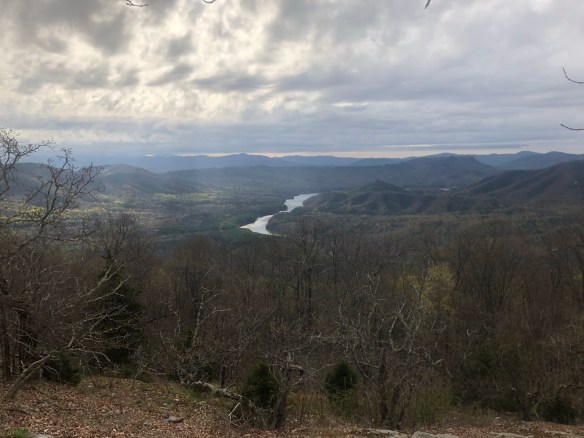
Day 53. It was all worth it. Yesterday’s long day and late night setup the most amazing views today for McAfee Knob. The weather forecast updated today, showing rain as early as 9am tomorrow, meaning anything other than seeing this today would have failed. I am very content as I sit here watching the sun set over the Knob.

When we arrived, we met 4 funny day hikers who were up here trying (and succeeding) to build a small fire on the cliff. We had a nice photo shoot while chatting with them, and learned one of them recently finished a section hike from Damascus to Pearisburg (the section I just finished). It was a great fun group to enjoy this milestone with, and it was a perfect afternoon in general.

But McAfee Knob wasn’t the only great view today. It is one of 3 elite views on the AT that day-hikers call the triple crown of Virginia: McAfee Knob, Dragon’s Tooth, and Tinker Cliffs. We did the first 2 today and will get the 3rd tomorrow on our way into Daleville. Here’s a photo from Dragon’s Tooth…

Between the two views, we took a quick side trip into the town of Catawba for a one-day resupply. Remy and I were both out of food and needed one more day before Daleville (where I have a box waiting). After a short shopping trip at the gas station grocery, we were offered a lift to a famous restaurant in town called The Home Place. This restaurant is one of a kind! We had an incredible lunch there of all-you-can-eat family-style southern home cooking. Two monstrous plates each of fried chicken, roast beef, coleslaw, mashed potatoes, green beans, sliced apples, beans and biscuits. YUM! And at only $15 a person, such a treat! Climbing back up the mountain again was rough after that meal, but it was a small price to pay for such great food.

I did feel bad though. This was clearly THE place to go in the area for everyone after church. The place was PACKED with families weating their Sunday best … and we were two dirty smelly hikers in the corner. We looked very out of place, but the staff didn’t mind and were very sweet. It’s a popular stop for thruhikers … perhaps not as much so on a Sunday though. Oh well.

After watching the sunset at McAfee Knob, Remy and I hiked a quick 0.7 miles to Campbell Shelter and setup camp in the dark for the 2nd straight night. I’m getting pretty good at it, though it typically means a late morning. Oh well, tomorrow is only 16 miles, so nothing to worry about.

Hello Neiman (Sharkbait!)

  • Start Mile: 695.6
  • Start Time: 09:30
  • End Mile: 713.8
  • End Time: 20:20
  • Miles Hiked: 18.2
  • Miles to Go: 1477.1
  • Lodging: Campbell Shelter

Day 52: Trout Creek Campsite

Day 52. I’m writing this very late, as I only got to camp a half hour ago and am utterly exhausted from today’s (and tonight’s) hike. Since the day was absolutely gorgeous, I took full advantage and hiked a comfortably long 26 miles into the night.

I realized from the comments that I may have sounded a bit gloomy in last night’s post. I’ll admit I was frustrated on that particular day, but the spirits are still ever high and the thruhike is in no danger of ending early! I appreciate all the kind words and motivation nonetheless, it was a nice reminder to turn my attitude around.

Today was fantastic though. Even with my pre-8am start time, I was still the last one out of bed at War Spur shelter. But I quickly caught 3 of the 4 other hikers that shared camp there last night by the time I reached Laurel Creek shelter 7 miles later.

While stopping for a snack at this shelter, I met a young man named Remy. Oddly, Remy and I have never met, even though we both started on March 1st. We exchanged pleasantries and asked about other hikers we may know, then decided to hike together. Our end goal for the day was the same and it’s always nice to hike with someone else.

While we hiked, I got to know more about Remy (named for the character in the movie Ratatouille). He is a recent college grad from Atlanta doing some soul searching before starting grad school in the fall. I’ve heard this story from many other hikers out here, but it’s still unique and interesting each time. It sounds like he has made some good progress already and is feeling good about his future life decisions.

Around midday, we passed a very very very large tree. This was the famous Keffer Oak, the largest oak tree in the southern half of the AT. Dover Oak, in NY, is slightly bigger … but this was no small fry. This tree was monstrous, and made for a great lunch break and photo op (see above).

After lunch, as I was just getting up to leave, I saw the smallest of red dots move on my arm. Looking closely, I was disgusted to learn I just spied my first tick on the trail. Well, no, not on the trail. On me! And what is worse … it was a deer tick. Ack! I’ve never seen a deer tick before, but I’m very familiar with them and was not pleased at all to find him invading my personal space. The good news, however, is that he was moving along my arm, and had not come close to biting me yet. I pulled out my camera for a photo and then my knife for a swift beheading. It was a clean kill, and I left the headless body on the ground as a warning to all his friends. Any other tick that comes near me will suffer the same gruesome fate.

The rest of the day was a really scenic and incredible ridge walk along the Eastern Continental Divide. Water on one side supposedly flows to the Mississippi River, while the other eventually leads to the James River/Atlantic Ocean. The view during this 5 mile stretch was just breathtaking. Almost good enough to justify the awful rock stepping. Almost.

When we reached Niday shelter, we found a Girl Scout group had taken the whole area over. Even if I wanted to stop at 18 miles, I would have been forced to go on. A dozen 12 year old girls giggling all night would be hard to sleep through. We chatted with the scout masters a bit and then headed out. By now it was 5pm, and any good stopping place was at least 6 miles away up and over Brush Mountain.

I got to the top of Brush just as the sun was going down. There was a bench at the top that served as a great place to rest my weary feet and watch a beautiful sunset. So I did … in Hello Neiman style. 🙂

The last 4 miles of the day were hiked at night. I am not normally a fan of night hiking, but this was short and all downhill. It was actually quite beautiful. With just a headlamp to light the way, I made my way down to the road in about an hour and a half and setup camp at a makeshift campsite next to the parking lot. I arrived around 9:30 and was surprised to see 3 or 4 tents already setup there. I quietly hung my hammock and ate a cold/dry dinner before crawling into bed.

I’ll probably sleep in a bit late tomorrow, as my feet and legs are beyond exhausted, but it was worth it. Today was one of those days I’ll remember fondly years from now, when I think back on this hike.

Hello Neiman (Sharkbait!)

  • Start Mile: 668.5
  • Start Time: 07:50
  • End Mile: 695.6
  • End Time: 21:30
  • Miles Hiked: 27.1
  • Miles to Go: 1495.3
  • Lodging: Trout Creek (VA Road 620)

Day 51: War Spur Shelter

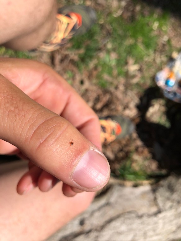
Day 51. As expected, I had a late morning. Last night was bitter cold, probably the coldest I’ve had sleeping outside. When it has been this cold in the past, it was usually accompanied by snow or rain, so I’d end up sleeping in a shelter. But last night was a unique cold-and-windy-but-dry night, so my ability to stay warm in the hammock was vigorously tested.

All in all, I slept fine enough. I went to bed later than normal, and had a few strong gusts of wind wake me, but I was so exhausted from yesterday’s hike, that I eventually fell back asleep. It was bitter cold and blowing hard in the morning too, so I was pretty much awake at 6:00am. Around 8:30, I finally gave in and crawled out of bed. I was not surprised to find a layer of frozen dew covering my tarp. I made a quick breakfast, hoping the sun would melt and dry the tarp. It didn’t. So I wiped down the tarp of its frost using a tiny towel and got work breaking camp. After slowly packing everything up, I was ready to hike around 9:30.

The good news is that the sun was shining throughout the day and it slowly heated up to a temperature in the mid 50’s. Good hiking weather.

The terrain was another story, of course. It was mainly ridge walking, with one significant 1500 ft elevation drop to a road followed by an immediate climb back up. That part wasn’t so bad, but the rocks layering the path all day was. I’m getting very sick off these stupid rocks. There are almost no rocks on either side of the trail, but where I’m supposed to walk is like a damn mine field. One misstep and it’s a twisted ankle or stabbing pain into the bottom of my foot. So I spent all day looking down and missing anything else of significance around me.

There was one great vista though, and the view was spectacular. Wind Rock is its name, and it gives you a taste of the upcoming famous view at McAfee Knob a couple days away. The scenery visible from Wind Rock was stunning so I snapped a pic (above).

McAfee Knob is at mile 713, about 45 miles from here. Every hiker on this trail is guaranteed to have 3 ceremonial photos taken: at the Amicalola Falls arch, at Katahdin’s summit, and at McAfee Knob. Do a quick google image search and you’ll understand why. It is the quintessential trail photo with the most stunning view of the Appalachian Mountains. I am extremely excited to finally get their to see the famous view and have my epic photo shoot.

However, I have a big problem. The weather is calling for 5 days of clouds and rain starting Monday. If I don’t get to McAfee Knob before that weather hits, I won’t have any visibility of the scenery to capture. And with that extended forecast, i won’t be able to wait it out for a better day … I could lose a whole week trying.

So, I’m left with one option. Hike 45 miles in 2 days. And get there for a hopefully awesome sunset shot, or a hopefully awesome sunrise shot the next morning. There are shelters within a couple miles on both sides, so I have close enough accommodations to make that plan work. And the rain is supposedly not coming until 2pm on Monday, so theoretically, all could work out. Theoretically …

I’m kicking myself for not going another 7 miles today to the next shelter, that would have helped significantly. I got hear early enough. But my feet are beat up from those rocks and I need a better night of sleep if I’m going to do double 20+ mile days in a row. I’m going to bed early tonight, so maybe I’ll wake up early enough to have a good long day tomorrow. Terrain looks tough, but we’ll see.

I know I know, it’s just a photo. No reason to kill yourself to capture it. It will always be there to come back and do another time. I know. But damnit, I’m thruhiking THIS year, so I want my photo NOW. 🙂

Hello Neiman (Sharkbait)!

  • Start Mile: 650.1
  • Start Time: 09:40
  • End Mile: 668.5
  • End Time: 17:45
  • Miles Hiked: 18.4
  • Miles to Go: 1522.4
  • Lodging: War Spur Shelter

Day 50: Unnamed Campsite

Day 50. Well, yesterday was a gorgeous and hot sunny day, so you know what that means … rain and cold today! It would obviously be too much to give us multiple warm days in a row, but can I at least have 2 in a row?! Nope, rain in the morning and a high of 45 degrees. I’ve heard this irregularly long cold season has ended many people’s thruhikes early, a sad reality to the impact weather has on a long-distance hike.

But I’m still here. And hey, today marks my 50th day hiking the Appalachian Trail! That’s pretty neat! I celebrated my milestone by eating an extra snickers bar at lunch. 🙂

I left Woods Hole Hostel around 9:30, after a great communal breakfast and a communal clean up of the bunkhouse. Everyone pitched in again and some even stayed to help out with more odd jobs around the house to decrease their bill total. I liked the idea of helping out Neville, as she was such a great hostess, but need to make up lost miles, so I got a hiking. And on cold days like today, there’s really only one thing to do. Keep hiking as long as possible.

I meant to stop in the town of Pearisburg after 12 miles, but I had no desire to hike the 1 mile down the road and back in this cold. The best thing in that tiny truck stop town anyways is a Dairy Queen … which, oddly, just didn’t motivate me today.

Before I realized it, I hiked 18 miles to the shelter I planned for this evening’s rest, but it was only 5pm, so I kept going. I didn’t really know my destination, but knew a few hikers were still ahead of me and plenty of campsites were coming up on the trail. About 8 miles later, I saw a familiar tent at a random unnamed campsite and joined Dragon for the night. The campsite is in the guidebook, but is nothing more than a clearing for 1 or 2 tents and a fire pit right next to the trail. By now it was after 7pm, and he was in bed, but we both appreciated having company nearby for the night. I know he’s an early riser, so probably won’t see him when I eventually crawl out of this hammock. And if it’s this cold tomorrow, that will be long after 8am I’m sure.

I passed by an interesting area today. For about a mile after Pocahontas Rd (mile 640), there were blue signs lining the trail talking of a protest against a new pipeline being planned along the AT. I eventually saw these “tree-sitting” a few miles later in visible protest against the Mountain Valley Pipeline that is planned a mile west in West Virginia. I didn’t really know much about it, and they were too far off trail to warrant a cold side trip to discuss, but I did some google searching and found this article which helped clarify.

If it were earlier or warmer when I saw them, I probably would have stopped to hear their story and learn more. But I was cold and exhausted, so I’ll leave that for tomorrow’s hikers to do.

I’m going to try to keep up my momentum of 25 mile days while this terrain stays relatively flat. I am about 100 miles behind schedule and think I can catch up by Harpers Ferry if the weather cooperates. Which I somehow doubt it will.

Hello Neiman (Sharkbait)!

  • Start Mile: 624.8
  • Start Time: 09:30
  • End Mile: 650.1
  • End Time: 19:15
  • Miles Hiked: 25.3
  • Miles to Go: 1540.8
  • Lodging: Unnamed Campsite

Day 49: Woods Hole Hostel

Day 49. Today was a great, leisurely Nero Day. It was only 7.5 miles to a Hostel in Pearisburg from last night’s shelter, and I contemplated skipping it because of my impromptu stay at one a couple days ago, but breakfast quickly changed my mind.

As I ate my morning pop-tart, I noticed a magazine was placed in the shelter and opened it to read. It was a 2010 edition of AT Journal with a feature article on Woods Hole Hostel, that recently came under new management. I’ll let you read it for yourself at the link above, as it’s a beautiful story and easily convinced me that this historic AT landmark up ahead was too good to pass up.

It was a beautiful day, and I took my sweet time hiking those 7.5 miles to really absorb it. I stopped at every creek, I visited every side trail and vista, I took numerous photos and videos, I walked a slow 2 mph, and I soaked in the sun. If I had the time, patience and finances to hike this trail in 9 months, I’d do every day like this.

When I finally came to the Sugar Run Road intersection, I turned right and hiked the half mile down to the scenic cabin on a farm. I’ve stayed at some great hostels, but this one may top them all. When you walk in, the animals literally come out to greet you and welcome you in … Dogs, cats, goats, and even a goofy looking pig. They all came to say hello.

Then you see an immaculate log cabin home, a large garden, a hiker bunkhouse, platform tents and more. Everything is clean and open and ready to be shared, and everything is decorated with cute and friendly painted information/instruction signs.

One of the best things about this hostel is how it is an instant community of helping hands. I saw 3 thruhikers setting up the platform tents, another folding laundry, and 2 more preparing lunch. You just feel at home here and want to be a part of it. No one was doing a “work for free stay” … they were just helping out. An optional “job jar” is in the bunkhouse with suggested chores to take on if you feel willing.

The owner, Neville, is a wonderful and spiritual person as well, which feeds the peaceful culture here. She leads yoga in the afternoons, meditation at night, and gives licensed massages in between. A neighbor will drive you into town for resupply, the staff welcome you with fruit smoothies, homemade cookies and cold sodas, and there are countless games and activities to do while you unwind. I mean, doesn’t this sound amazing?? Am I thruhiking or at a spa retreat?

I grabbed my resupply box that was mailed here, then picked up a guitar and played music by the fire pit in the sun. It was the rest for body and soul I needed. After a while, I offered to help cook dinner and assisted in the kitchen to prepare our communal meal. Stir fry with beef and vegetables, salad, bread, egg salad, and more. All homemade and fresh, with most ingredients grown right here. Talk about farm to table!

When dinner was ready, Neville led everyone in a quick round of thanks and sat with us to talk about her life, her family, the world, and more. She is an amazing woman who runs this place all on her own (with some temporary support staff), continuing the great tradition her grandparents started 30+ years ago.

There are a lot of people here. My current hiking mates of Ridge, Autopilot and Dragon are all here, and a dozen more I mostly know. RTK is also here, so he and I had a chance to chat a bit more. Our passing on the trail a couple days ago was brief, so this time we got a better chance to get to know each other. I am not sure if we’ll meet again, but it’s been great connecting with him after so many email exchanges pre-trip.

I got in a few calls to family back home when the phone service cooperated and then called it a night. I’m headed out first thing after breakfast tomorrow, but feel completely revamped for another week on the trail.

Hello Neiman (Sharkbait)!

  • Start Mile: 617.6
  • Start Time: 09:00
  • End Mile: 624.8
  • End Time: 12:10
  • Miles Hiked: 7.2
  • Miles to Go: 1566.1
  • Lodging: Woods Hole Hostel

Day 48: Wapiti Shelter

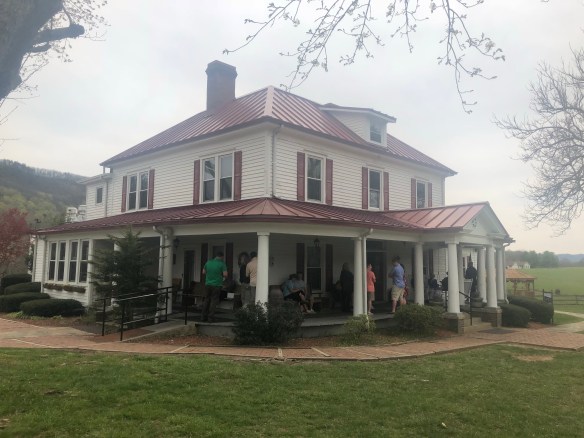
Day 48. Today was a pretty standard day, so I’m going to write about something a little different that seems relevant now that I am in my groove and hiking on my own terms everyday. Since today felt pretty average, putting in 20+ miles and a couple side adventures, I thought I would describe my daily routine. A Hello Neiman / Sharkbait “day in the life” if you will …

6:00am – Wake up from the sounds of other hikers packing up. These are the “early bird hikers”, but I’m not one of them, so go back to sleep.

7:30am – After a few more bouts of sleeping / waking, I give in to morning and get out of bed. Most nights are spent in the hammock, so the first thing I do is break down camp. I like to have my quilts, tarp, and hammock all packed up so everything is in its stuff sack before breakfast. This makes it easier to pack and go right after eating.

8:00am – Breakfast time. I untie my bear bag from the nearby tree and pull out the gallon ziplock bag of one day’s neatly organized rations. I setup my stove and boil 2 cups of water for coffee, then nosh on my pop-tarts, cereal bars, or other cold breakfast foods while sipping coffee to wake me up.

8:30am – Typically the coffee has worked its other magic by this time, allowing me to do the day’s business at the shelter’s privy (better than a hole in the woods later).

9:00am – After reviewing the day’s itinerary, end-goal, and side adventures for the day in my Guthooks App and AWOL Guidebook, I set out on the AT. I like to have a general idea of where I’ll stop for water, lunch, etc. so I’m not pulling my phone out every mile on the trail.

9:30am – Hopefully I have phone service, as I try to call my wife on her way to work each morning. Being on the west coast and working late hours, it’s pretty much the only time that works for both of us. I try to check in everyday if I can, and like to hear what is going on back home.

10:00am – About an hour into the day’s hike, I start snacking. I pack 3 snacks in my backpack’s side pocket so I can grab and eat without stopping. Candy bars, trail mix, and dried fruit typically make up the morning snacks. I have about one per hour, until lunch. After each snack, I can physically feel the momentary rush of energy in my feet. That’s pretty neat.

11:00pm – By now I’ve probably drank all my water (I only carry 2 small 700ml bottles now), and fill up at the next stream I see. I like to have full bottles going into lunch, and get a bit anxious when they are both empty. This is silly though, as I pass creeks and streams about a dozen times a day. There is never a shortage of available water to fill, but your mind doesn’t always believe it. Since my water purification is treating with Aqua Mira drops (chlorine solution), I need to wait 5 minutes between mixing the solution and pouring it in my bottle. I use this excuse to take off my pack and have a mini break while eating a snack.

1:00pm – Lunch time. I try to time it so I can eat lunch at a major landmark. Either a shelter with a picnic table, a mountain summit with logs to sit on, or a waterfall if I’m lucky. Most days, one of these is readily available. Lunch is typically tortillas with filling. Either meat, cheese, tuna, or peanut butter. I also have something salty/savory, and fruity. Goldfish crackers and fruit snacks seem to be common these days. I typically see another hiker to have lunch with, but not always.

3:00pm – Its about now that the energy from lunch wears off. I’ve hiked between 10 and 15 miles and fatigue is starting to set in for the day as well. I typically turn to upbeat music or my book on tape to get me through the last few hours.

5:00pm – There is always some major landmark I’m looking forward to each day. Part of the morning’s planning is to pick it out. Let’s just assume this is the time I see it, even though we know that’s not always the case. It can be a lake, river, summit, unique view … or the past two days, a roadside market/grill. It’s easy to pass these things up, as they are usually a side trail and cut into your official mileage for the day, but they are worth the stop. I’ll take a break and eat my afternoon snack (energy bar), while taking in the views around me.

6:30pm – About the time I have a mile left to the shelter. This is the LONGEST mile of the day. It never fails, like a watched pot trying to boil, every minute ticks by slowly and the end never seems to come. I’ll also fill up water too, as I like to go into dinner with full bottles.

7:00pm – My destination is finally reached! I stroll into the shelter or campsite area and immediately setup my hammock. They say you should eat first, but I don’t want to lose a good camp spot to whoever arrives next. If the weather is rain or snow, I’ll opt to sleep in the shelter, but I never like that decision as I sleep very poorly (if at all).

7:30pm – Dinner time. Most of the hikers are done with dinner and laying in bed by now, so I quietly boil my water. Earlier on, people stayed up late chatting, but it seems less and less so as the days pass by. Dinner is a big meal for me, comprised of noodles, rice, or beans. The dinners I send in my resupply boxes are quite gourmet, compared to the instant potatoes or ramen you typically see. I’m super thankful to the people at MRE Depot for sponsoring my mealplan with their freeze dried meats, as eating dinner is the highlight of my day. I’ll admit, I like the jealous stares I sometimes get from others, and will often share or trade a dinner with anyone who inquires about it.

8:00pm – After cleaning up dinner, I repack my food bag and hang it in a tree. There used to be bear cables at shelters, but I haven’t really seen many since the Smokies. This is probably why most other hikers stop hanging their food around this point in their thruhike. On really rainy/snowy days, I’ve been lazy, but 9 times out of 10, I hang it.

8:15pm – After dinner, I brush my teeth, change in to sleep clothes, and crawl into bed. Hopefully in my hammock, but on rainy/snowy days … you get the idea. Have I mentioned lately that there have been WAY too many snowy days?!

8:30pm – On some nights, we build a fire. About once a week these days, which is typically when the inhabitants of the shelter are friends or it’s an especially cold night. I like the campfire days, but it can be tiresome too, as I’m exhausted from the day. With or without a fire, it’s considered “hiker midnight” as soon as it gets dark, so anything done now is done quietly.

8:45pm – Whether around the campfire, or in my bed, I write my day’s blog. It doesn’t take long, about 30 minutes or so. Most of us write in a journal, read a book, or do other things on our phones to unwind around the same time. On warmer nights, if the trees allow visibility, I like to stargaze a bit too. I’ve loved that part of camping all my life and rarely miss a good chance to stare at the night’s sky in awe. All in all, this is a collective personal quiet time for everyone.

9:30pm – By now I am in bed and hopefully asleep. Before passing out, I’ll do some foot and toe stretches, then message with friends and family if there is service. After passing out, I’ll wake up once or twice during the night, but less so if in my hammock. It’s usually a pretty restful sleep, and then I’m ready to go again in the morning!

Hello Neiman (Sharkbait)!

  • Start Mile: 593.4
  • Start Time: 09:30
  • End Mile: 617.6
  • End Time: 19:15
  • Miles Hiked: 24.2
  • Miles to Go: 1573.3
  • Lodging: Wapita Shelter